30 Jun 2026 – Version 2.0.0
🚀 Improvements & Enhancements
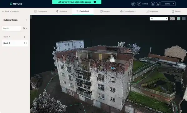
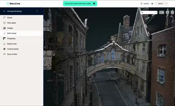
- New – Major Portal Redesign: A completely refreshed interface that’s more intuitive and easier to navigate. Tabs now sit in a bar across the top, scans are selected from the lefthand column, and you can switch between point clouds, floor plans and other views across two scans with a single click. Scan searching and filtering have also been improved.
- New – Site View: Re-walk a scan in first-person. View a top-down 2D floor plan, then click any green dot to see the original image captured at that point, alongside a 3D point cloud view of the same spot — making it far easier to reference a building, especially if you weren’t the one who scanned it.
- Improvement – Floor Plan Quality: Better floor plans generated through improved point cloud segmentation.
- Improvement – Faster Scan Uploads: Scans now upload faster thanks to reduced file sizes, with more processing handled in the Portal.
- Improvement – Point Cloud Colourisation: Noticeably improved colour accuracy across point clouds.
- New – Point Cloud Cleaning: A new cleaning method removes noise and moving objects from your scans.
- New – Scan2BIM AI Upgrade: Switched to an offline, deep-learning based Scan2BIM method. Wall feature recognition is now more accurate, giving you cleaner plans ready for use in Revit and similar tools.
- Improvement – Sensor Driver Updates: Improvements to device IMU and camera timestamping for more reliable data capture.
- Improvement – Bright Sunlight Camera Performance: Better camera performance in direct sunlight.
- New – Face Blurring: Face blurring is now included as a processing step. (License plate blurring is built but currently disabled due to processing time.)
- Improvement – Faster Scan Start/Stop: Starting and stopping a scan is now quicker.
- Improvement – Reduced Upload Size: Portal upload size cut by roughly 50%, making uploads twice as fast.
🛠️ Issue Resolutions
- Fixed an issue preventing PDF download of custom floor plans.
- Fixed a bug affecting Custom Slices.
- Reduced occurrences of missing snapshots during long scan runs.
- Fixed incorrect control point alignment when a control point frame was close to the origin.
- Improved postprocessing speed and reliability for very large scans.
- Fixed a rare issue where mapping data could be lost when stopping a scan.
