Scan fast.
Design better.
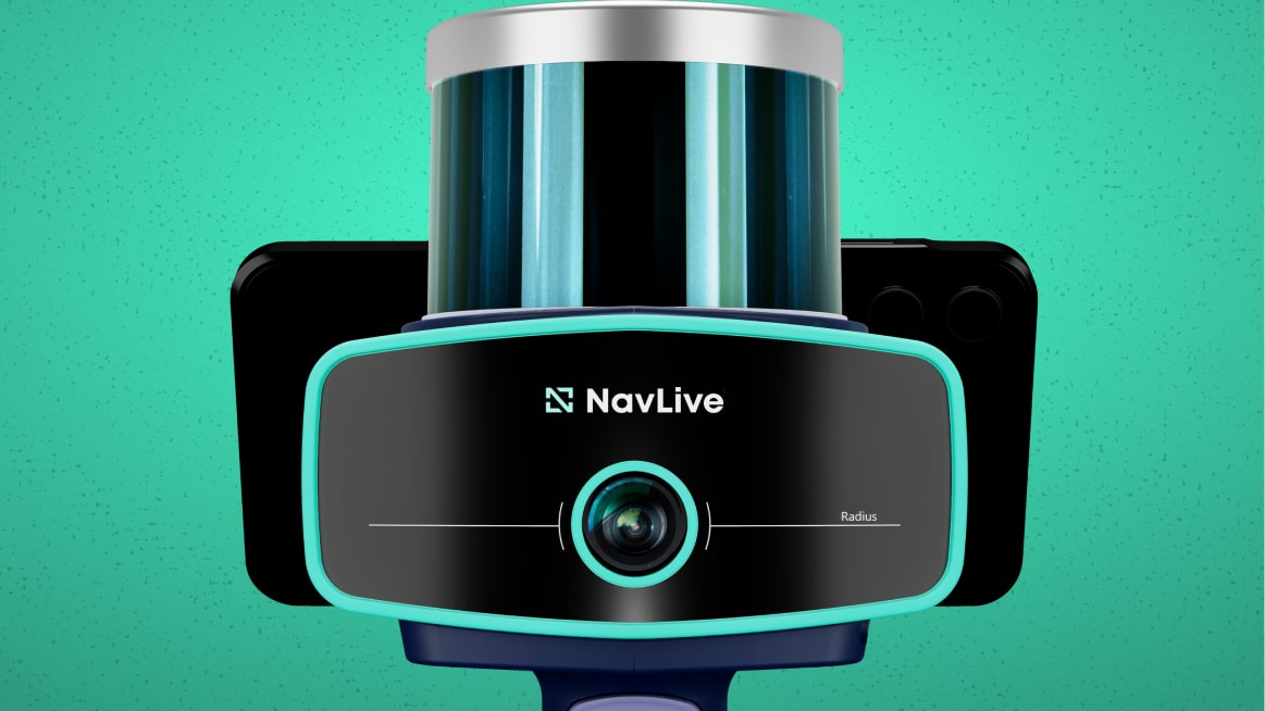
Say goodbye to slow surveys with high-precision AI-powered building site scans from NavLive

Say goodbye to slow surveys with high-precision AI-powered building site scans from NavLive
Relied on by architects and building professionals to generate real-time 2D and 3D models, collect detailed survey data, and speed up every stage from design to build.
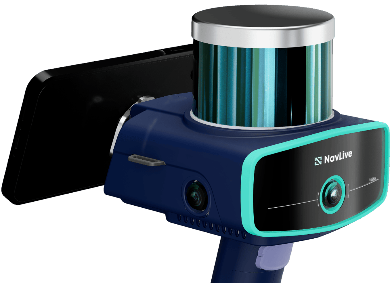
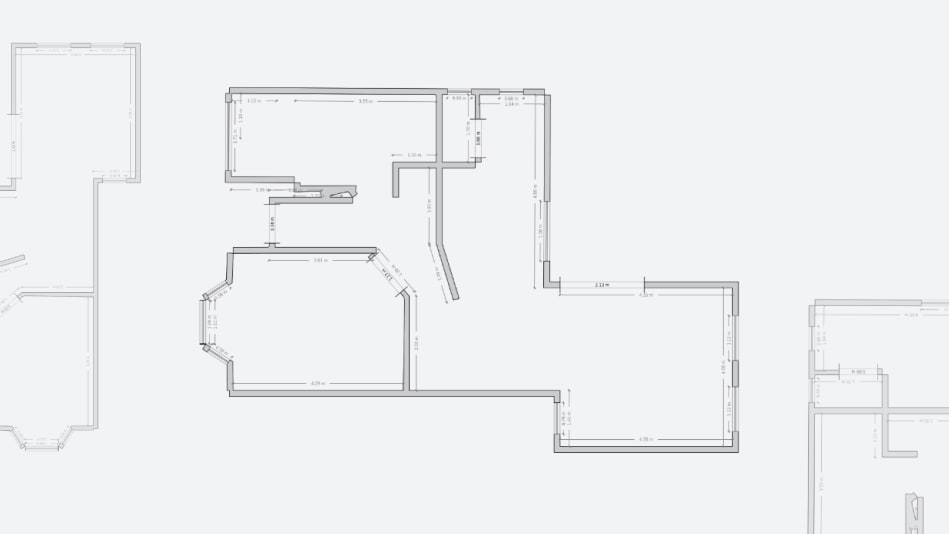
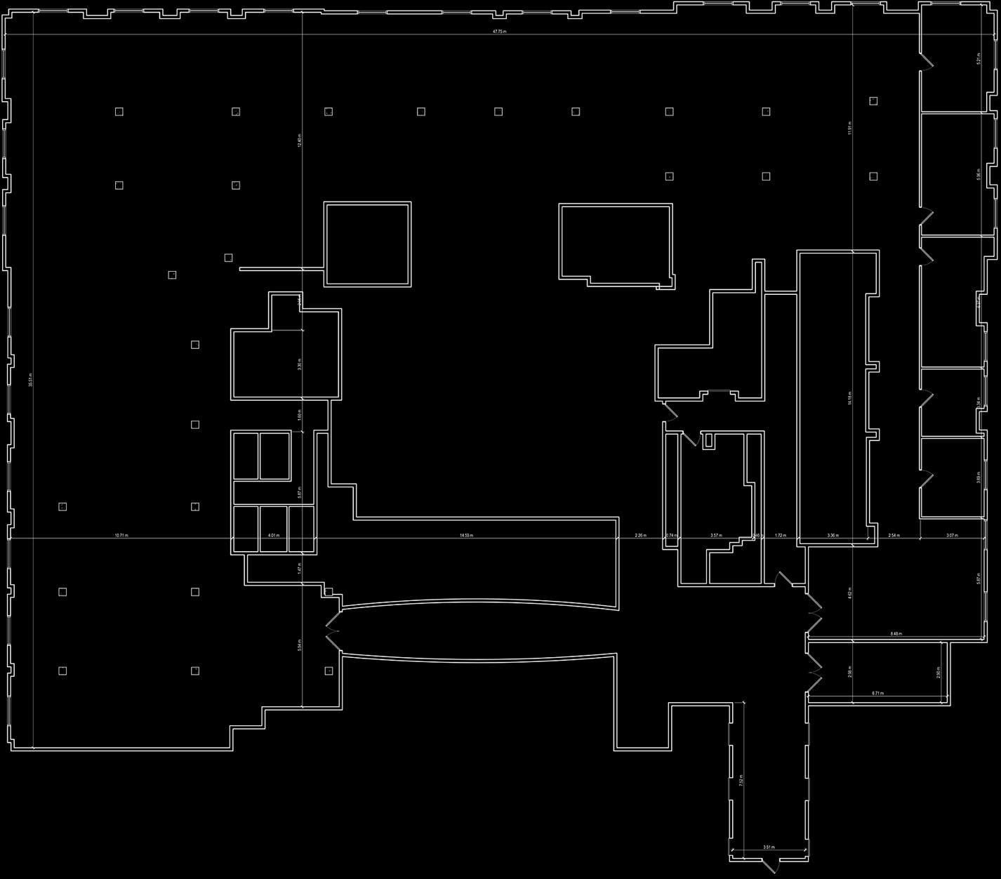
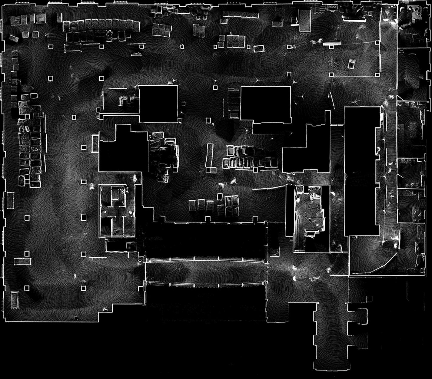
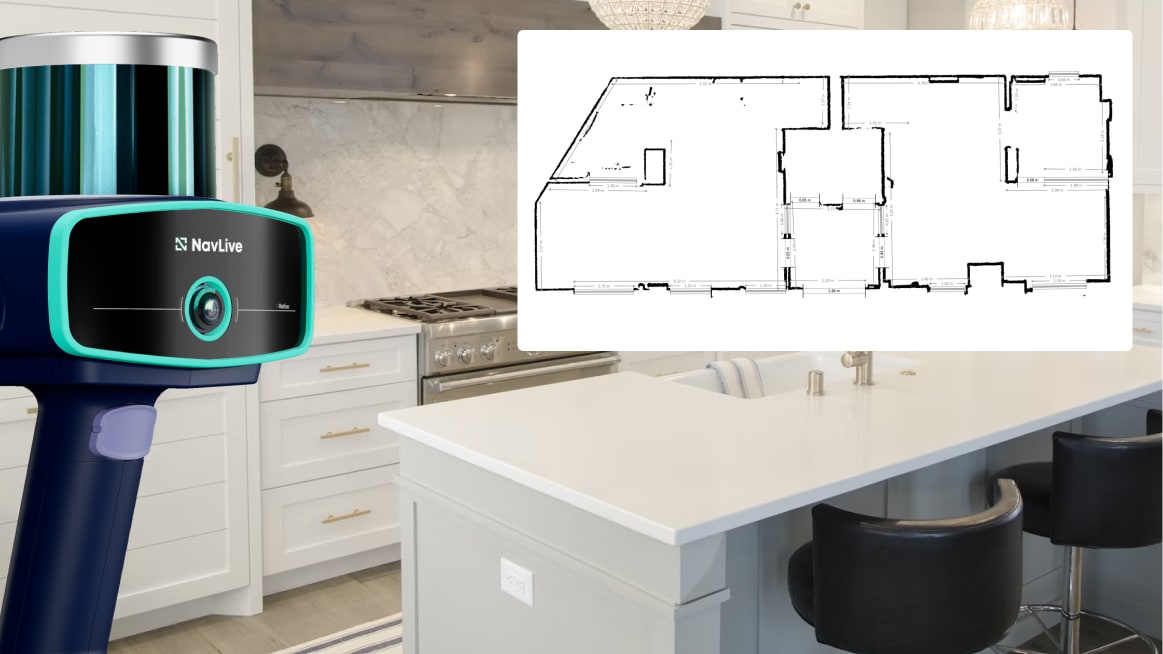
The NavLive Radius scanner combines cutting-edge LiDAR, AI processing, and Scan-to-BIM functionality in a lightweight device—delivering instant floor plans, point clouds, and site documentation without the usual setup or delays.
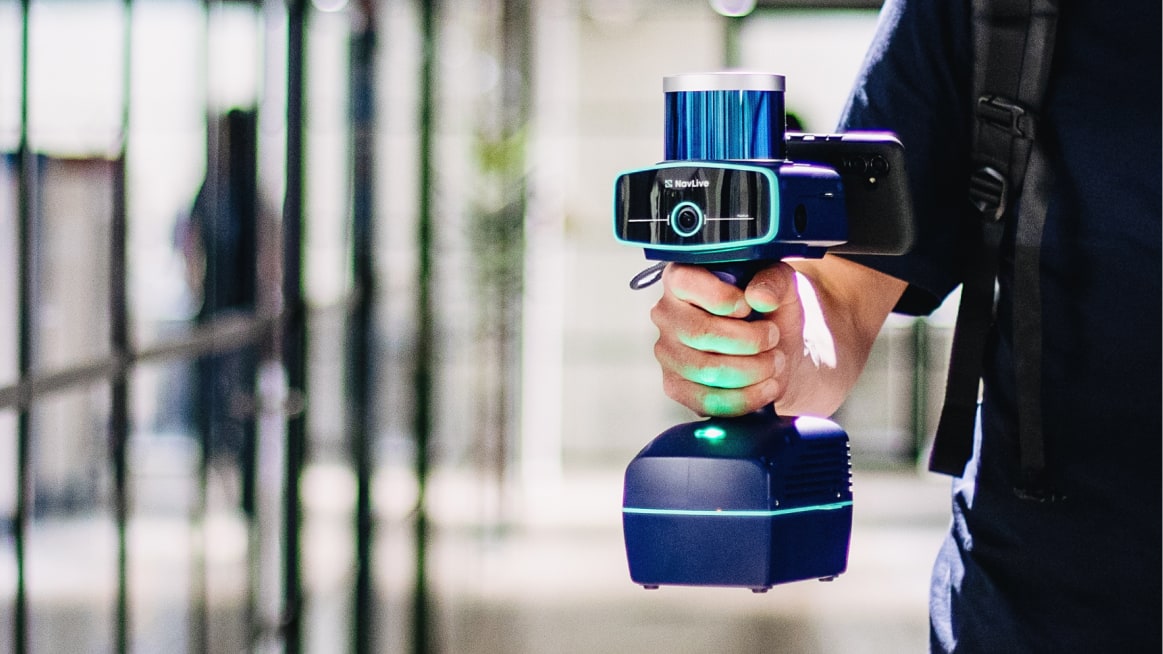
NavLive was built around real site workflows. Reality capture fast enough for a short site visit, accurate enough to design from without repeat visits.
RICS-grade measured surveys in a fraction of the time, with no additional kit or crew.
Capture as-built conditions on site and import point clouds directly into Revit, AutoCAD, or ArchiCAD.
Survey live workspaces without disruption. Get accurate plans ready for the design team same day.
Capture detailed spatial layouts in occupied or cluttered spaces. No tape measure needed.
Document building conditions across your portfolio quickly. Always have current, accurate floor plans on hand.
Make faster, better-informed decisions with accurate existing building data from day one, without any delays waiting on surveys.
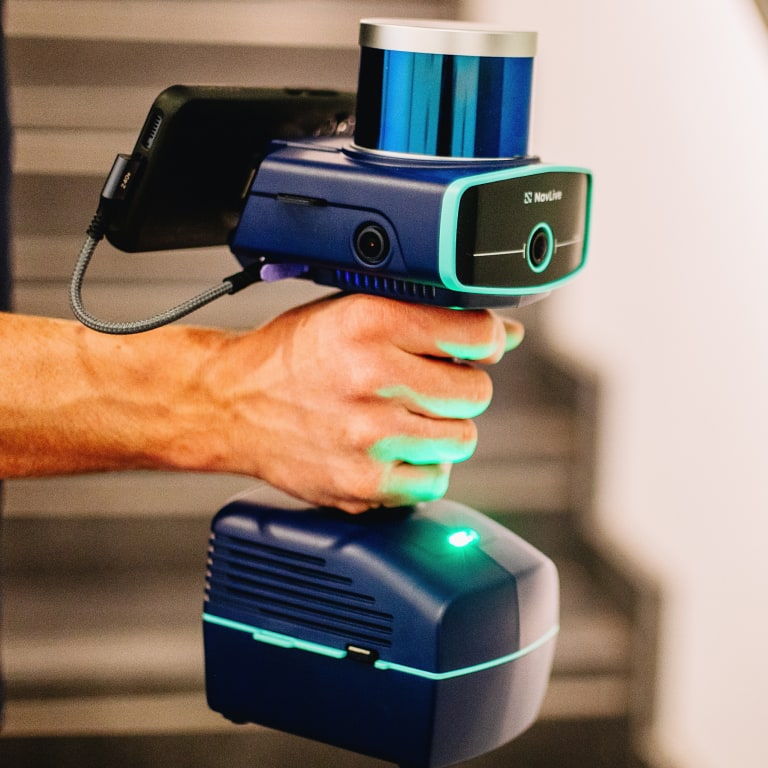
The NavLive scanner makes it quick and easy to capture accurate building measurements in minutes.
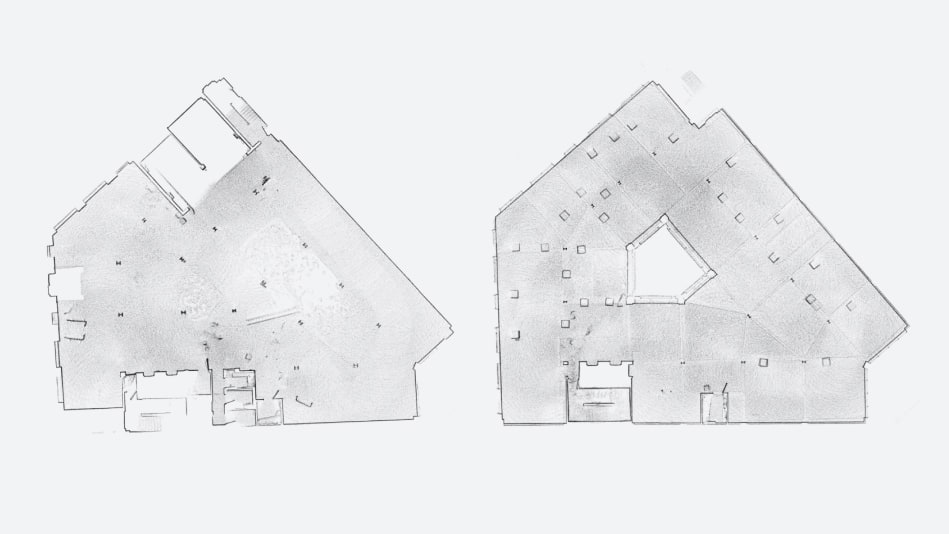
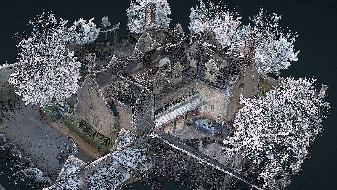
Accurately capture existing site conditions in a single walk-through with the NavLive Scanner. As you move through the site, 2D floor plans and a registered 3D point cloud are created in real time, with data ready shortly after upload.
Access all your NavLive scans from any device through the Portal. Review floor plans, point clouds, and imagery in one workspace, make quick edits where needed, and get your data ready for BIM.
Import NavLive point clouds directly into tools like Revit, AutoCAD, and SketchUp. Work over accurate as-built data to produce drawings faster, with fewer site visits and less rework.
 AutoCAD
 Revit
Revit
 SketchUp
 Archicad
NavLive was designed from the ground up to meet the demands of modern architecture, engineering, and construction. But its flexible, SLAM-based scanning platform also makes it the ideal foundation for custom solutions across defense, infrastructure, and industrial sectors.
Instantly capture detailed floorplans and spatial layouts to guide design decisions, even in cluttered or occupied spaces.
Survey active workspaces without disruption—move freely and capture everything in a single pass.
Document complex existing conditions quickly, streamlining the transition from scan to BIM.
We co-develop custom SLAM workflows for mapping, navigation, and inspection—ideal for defense, infrastructure, and other complex operational environments.
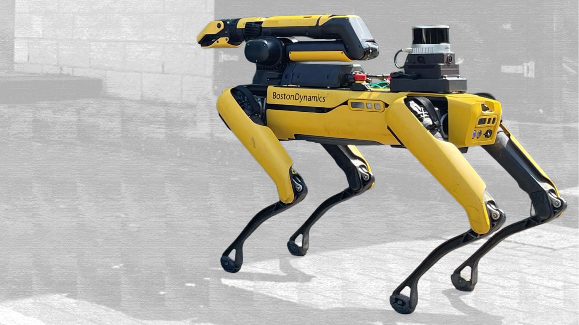
The scanner could be mounted on a robot dog to generate scan data of sensitive or restricted areas, keeping teams out of hazardous areas.

Tight, dark, or dangerous spaces could be mapped with SLAM-based scanning that adapts as you move.
NavLive helps you document a building accurately in one walk-through and use that data across your workflow.
When you capture a site with NavLive, you start your project with accurate information that reduces uncertainty later.

“NavLive has completely transformed the way we survey, saving countless hours of work. We no longer need repeated site visits to verify details as the scanner generates both a precise point cloud model and accompanying images.”

“The NavLive scanner has significantly accelerated our design workflow and achieved measurable cost savings while improving the accuracy and assurance of our model data. It's been used by staff across all levels of experience, delivering consistent results.”
Capture and view site data in real-time with NavLive (not days).
Upload scans straight from site to your team back at HQ.
Forget bulky files that take ages to upload — process and share instantly.
Start your floorplan designs while you're on site with the client.
Meet tight deadlines and keep projects moving.
With NavLive, you deliver faster, pitch stronger, and secure more contracts.


We’re proud to partner with leading names in construction, architecture and academia to help bring NavLive’s vision to life.