What can we help you with?
What’s in the Box
An overview of everything you get with your Navlive Radius scanner.
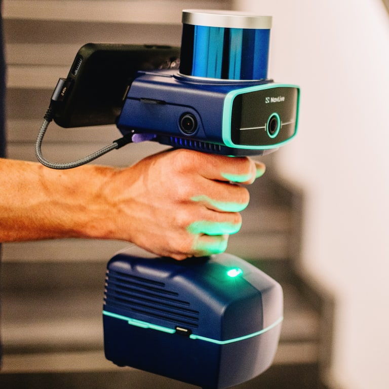
Setting Up Your NavLive Scanner
Use this step-by-step guide to set up your NavLive Scanner correctly.
Getting Started With A Scan
Learn how to complete your first NavLive scan, from startup to reviewing results.
Capturing Building Objects
Capture windows and doors as you scan, which will be added to your AI floor plan.
Adding Notes
Adding notes lets you capture extra details to remember, follow up on, or share.
Stopping a Scan
After scanning, stop and save to process data for review, sharing, and uploading.
Working With Control Points
Learn how to capture and align Control Points to improve scan accuracy and consistency.
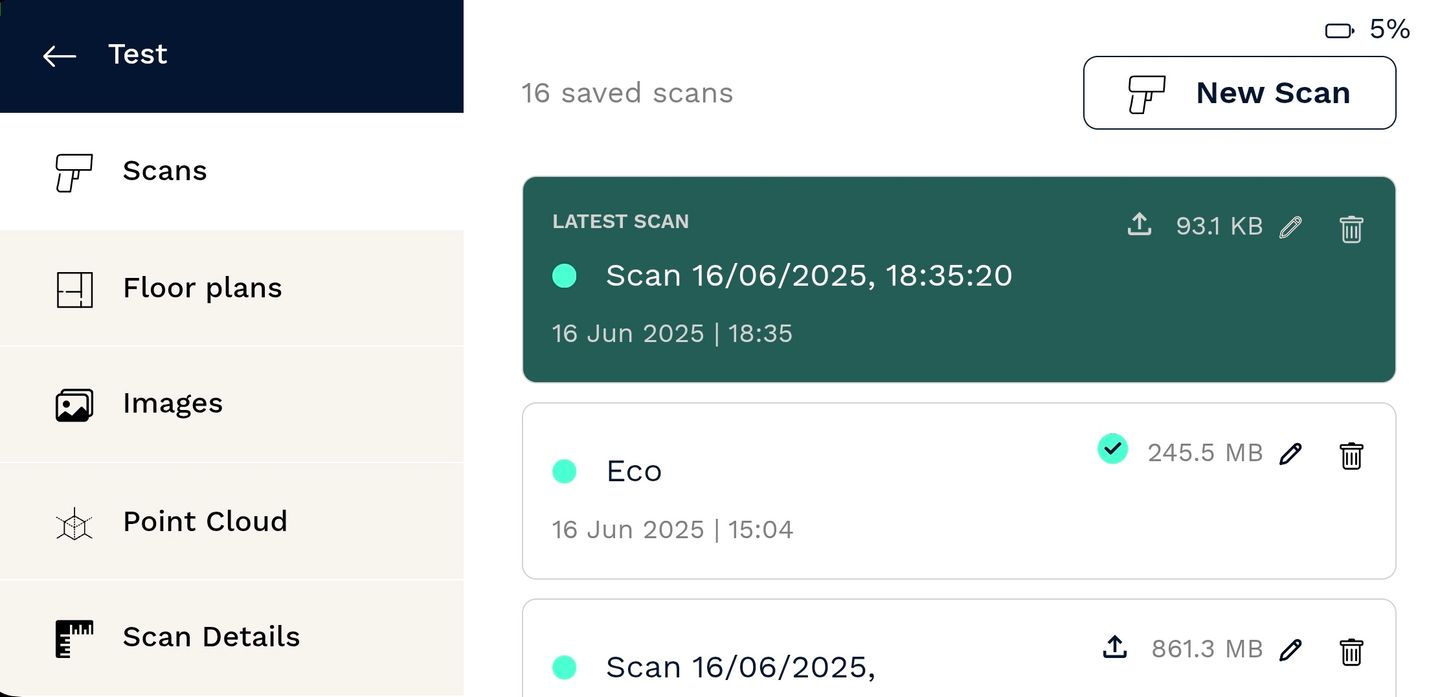
Viewing Your Scan Results
NavLive creates 2D floor plans and 3D point cloud data for you to explore, verify, and share.
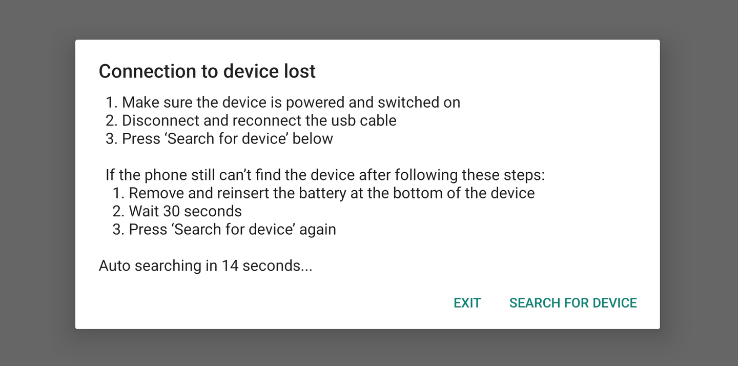
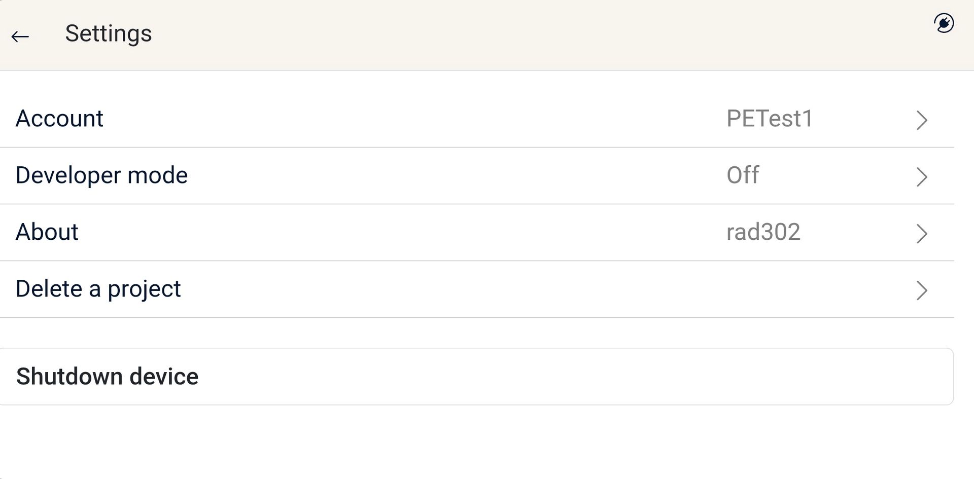
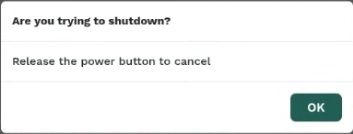
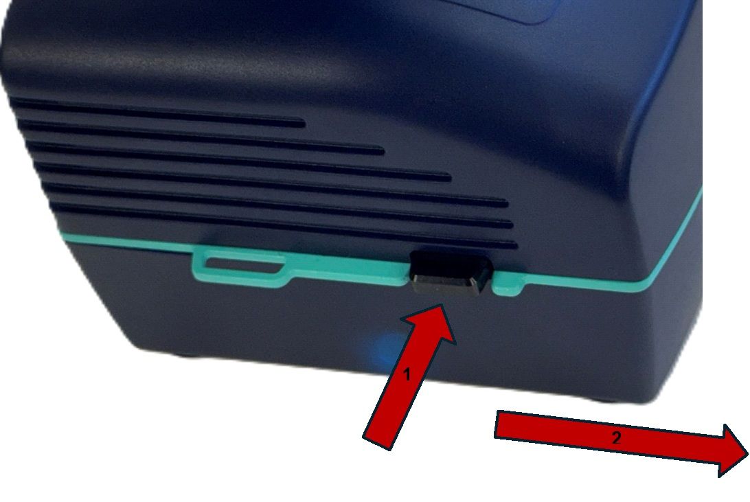
Shutting Down The Scanner
To save battery and maintain performance, you should shut down your NavLive Scanner after each use.
Working with NavLive Data
Learn how to make the most of your NavLive data in your favourite BIM tools like AutoCAD, Revit, and SketchUp with our step-by-step video guides.
Working with NavLive Data in AutoCAD
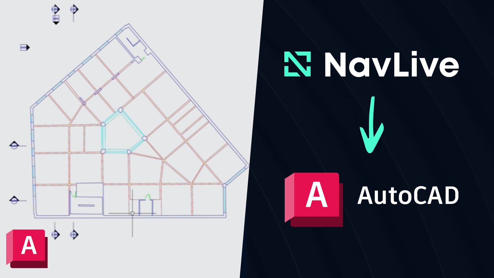
A step-by-step guide to using NavLive data in Autodesk AutoCAD for creating accurate building drawings.
Read NowWorking with NavLive Data in Revit
Discover how to integrate NavLive data into Autodesk Revit for detailed and efficient building design.
Coming SoonWorking with NavLive Data in SketchUp
See how to bring NavLive data into SketchUp and quickly model your building projects with precision.
Coming Soon