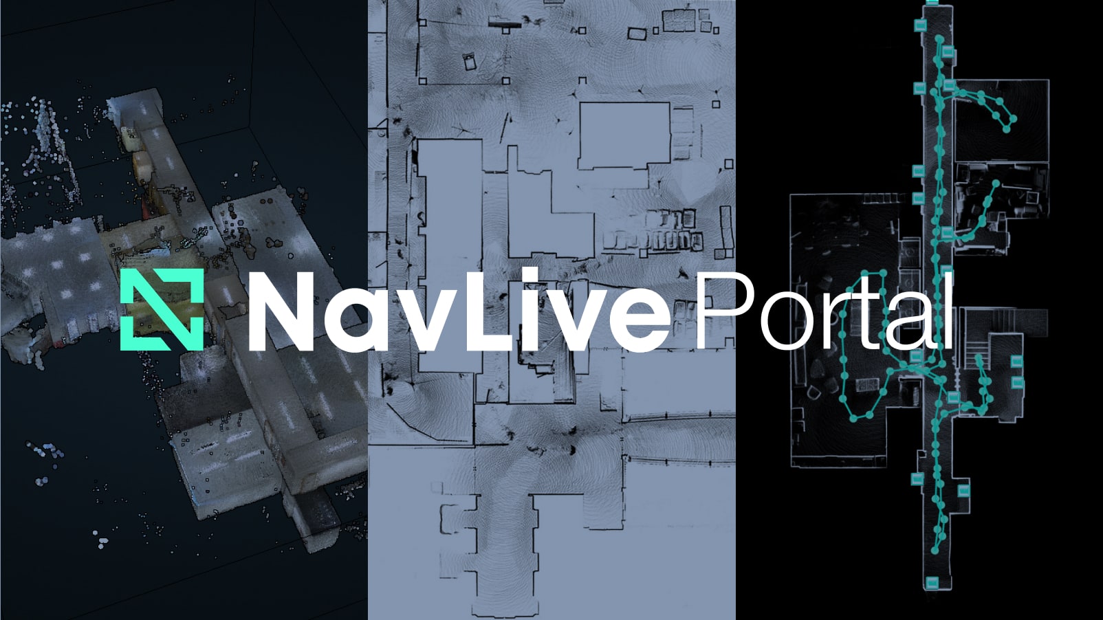
Introducing the NavLive Portal: All Your Scan Data, Instantly Accessible
We are excited to share the latest iteration of the NavLive Portal, a powerful, AI-driven web platform that gives architecture, engineering, and construction (AEC) professionals instant access to their NavLive scan data.
Built to complement the NavLive handheld LiDAR scanner, the Portal turns raw building scans into usable, export-ready floor plans, elevations, point clouds, and more, all available from your browser, moments after scanning.
A New Standard for Real-Time Site Data
Historically, capturing site conditions meant waiting days or even weeks to receive plans from manual surveys.
With NavLive, those delays are gone. As soon as a building is scanned with the NavLive device, the data is processed on-device and uploaded to the cloud, meaning your team can access and explore the scan in real time via the NavLive Portal.
Whether you’re on site or back at the office, the Portal becomes your central hub for reviewing layouts, verifying measurements, and exporting files. It’s built for speed, accuracy, and simplicity, making it easier than ever to keep your team aligned and your project moving forward.
Key Features of the NavLive Portal
🔹 Cloud-Based Project Library
All your scans are automatically organised by project in a clean, searchable library. From here, you can view, manage, and share scans across your team, from any device, anywhere in the world.
🔹 Auto-Generated Floor Plans & Elevations
The Portal creates detailed 2D drawings directly from your scans. That includes top-down floor plans, vertical slice elevations, and building sections, even across multiple floors. These plans are clean, readable, and ready to share or export.
🔹 AI-Enhanced “Smart Plans”
Toggle on AI Plans to view intelligent overlays, showing interpreted walls, doors, windows, and dimensions extracted from the scan. The better the scan, the smarter the plan. It’s real-time Scan-to-BIM, simplified.
🔹 Visual Walkthroughs with Image Capture
The Portal includes every image captured by the three onboard cameras during scanning. Use “Route View” to step through the path of the scan, with each photo anchored to its exact location. This becomes a valuable reference for documenting site conditions from back in the office.
🔹 Built-In Measurement Tools
Quickly measure spaces directly within the Portal. Just click to draw an area or space, and get real-time square metre estimates. Edit or remove measurements as needed, no CAD software required.
🔹 3D Point Cloud Viewer
Dive into a full 3D view of your scan using real-time web-based rendering. Pan, zoom, rotate, and slice through millions of points, all from your browser, without heavy downloads or plugins.
🔹 Easy Export Options
When you’re ready to move data into your existing workflow, export floor plans as PDF or DXF, and point clouds as PCD or LAS. Support for Trimble Connect and SketchUp is coming soon, and as an Autodesk Authorized Developer, NavLive is built to integrate seamlessly with industry-standard tools.
One Platform, Every Phase
NavLive is more than a site survey tool. It’s a platform designed to support every phase of a building’s lifecycle.
During design, it helps verify existing conditions. During construction, it tracks progress and provides measurable documentation. After handover, it serves facilities and maintenance teams with accessible, trusted data.
NavLive CEO Chris Davison puts it best:

“Generating building scans and plans has long been a slow, costly process. With the NavLive Portal, that pain is gone. We’re building the underlying record of trust for spatial data across the entire lifecycle of a building.”
Backed by Innovation
NavLive recently raised £4 million in funding, led by deep tech investor OSE, with backing from SOSV, Oxford Capital Partners, and others — including a £700K grant from Innovate UK. The Portal is the latest step in the company’s mission to make real-time, AI-enhanced building data the new industry standard.

Try It Today
If you’re ready to streamline your scan-to-model workflow and take full control of your site data, the NavLive Portal is here to help. Click the BOOK A DEMO button at the very top of this page to set up a short discovery call today.
We’d love the opportunity to tell you more about how NavLive can help improve your construction processes.
